The National Park Service has a great Web site Discover our Shared Heritage, offering travellers 60 itineraries to visit over 3,000 properties listed in the National Register of Historic Places. Fantastic.
But if you like to set your goals a little higher, our optimal tour to walk to 49,603 sites is ready and waiting for you. The full tour has length 350,201,525 meters, or just over 217,605 miles. That is between 8 and 9 laps around the equator, but it is surely comforting to know that you won't be wasting even a single meter by following our itinerary.
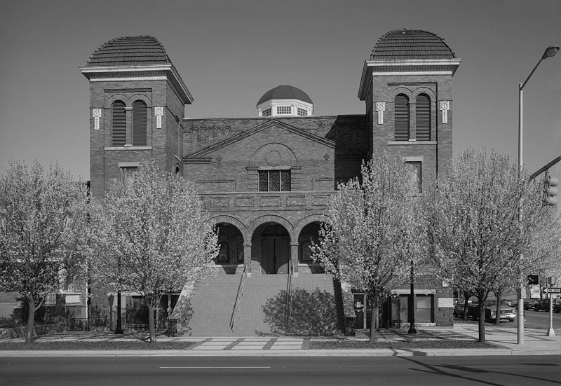
You start in Birmingham, Alabama at the A. G. Gaston Building, dash around the country seeing 49,601 other sites, before winding up your tour at the Sixteenth Street Baptist Church.
You'll see plenty of US history along the way. Click here for the list of sites, one and another, in the correct order.
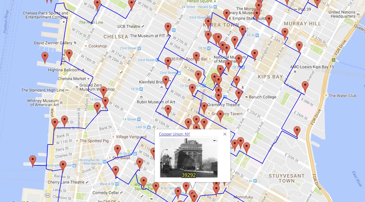
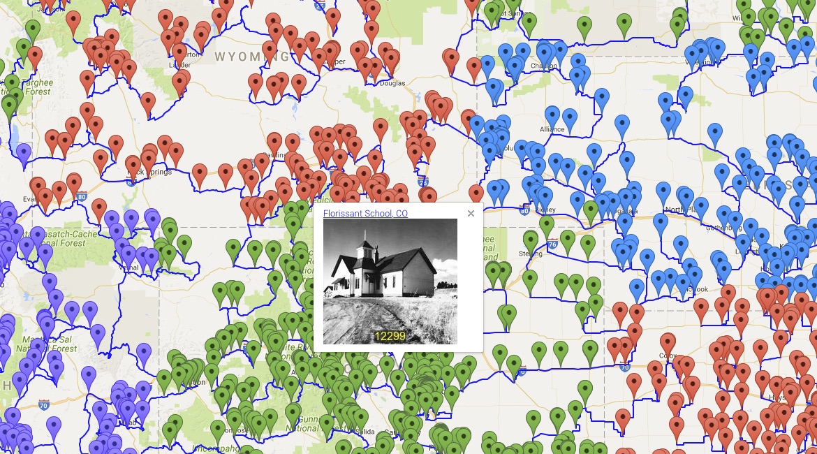
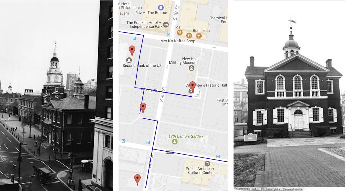
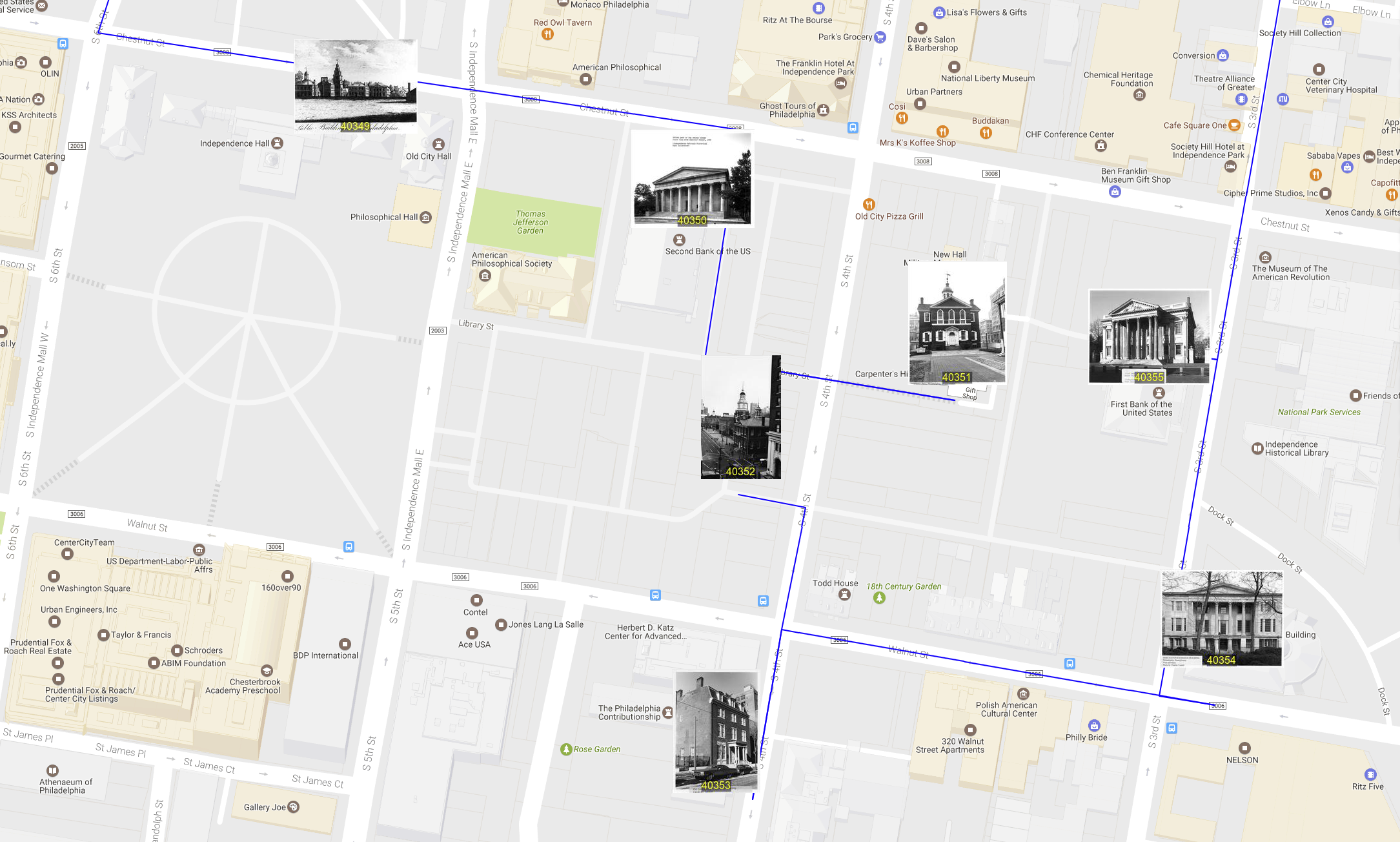
Circling the Earth 8 or 9 times is perhaps too much of a journey for most of us, even if you opt for a bicycle to speed you along the way. But don't worry, you can still enjoy a tour of history by viewing an interactive map of the full route. You can zoom in and pan around to see details, hover the mouse over markers to see photos from the NPS Archive, and click through links to read about the details of the various sites.
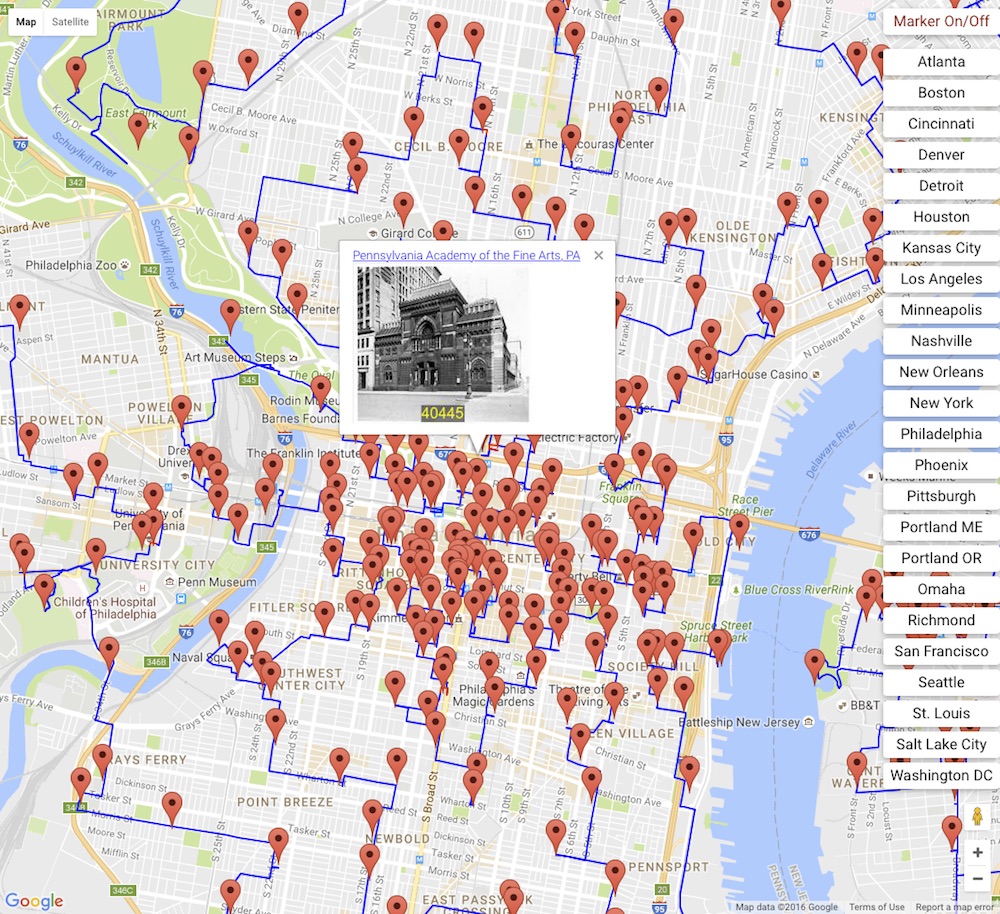
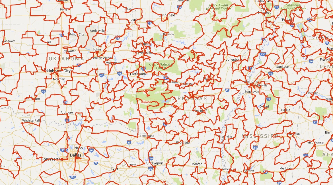
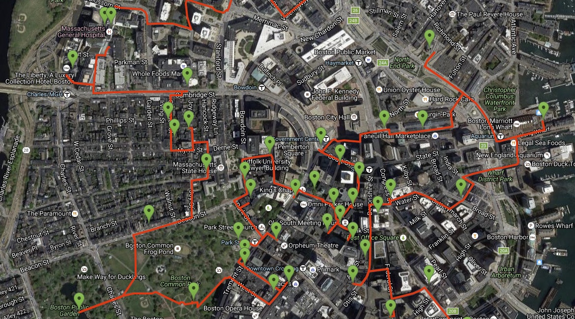
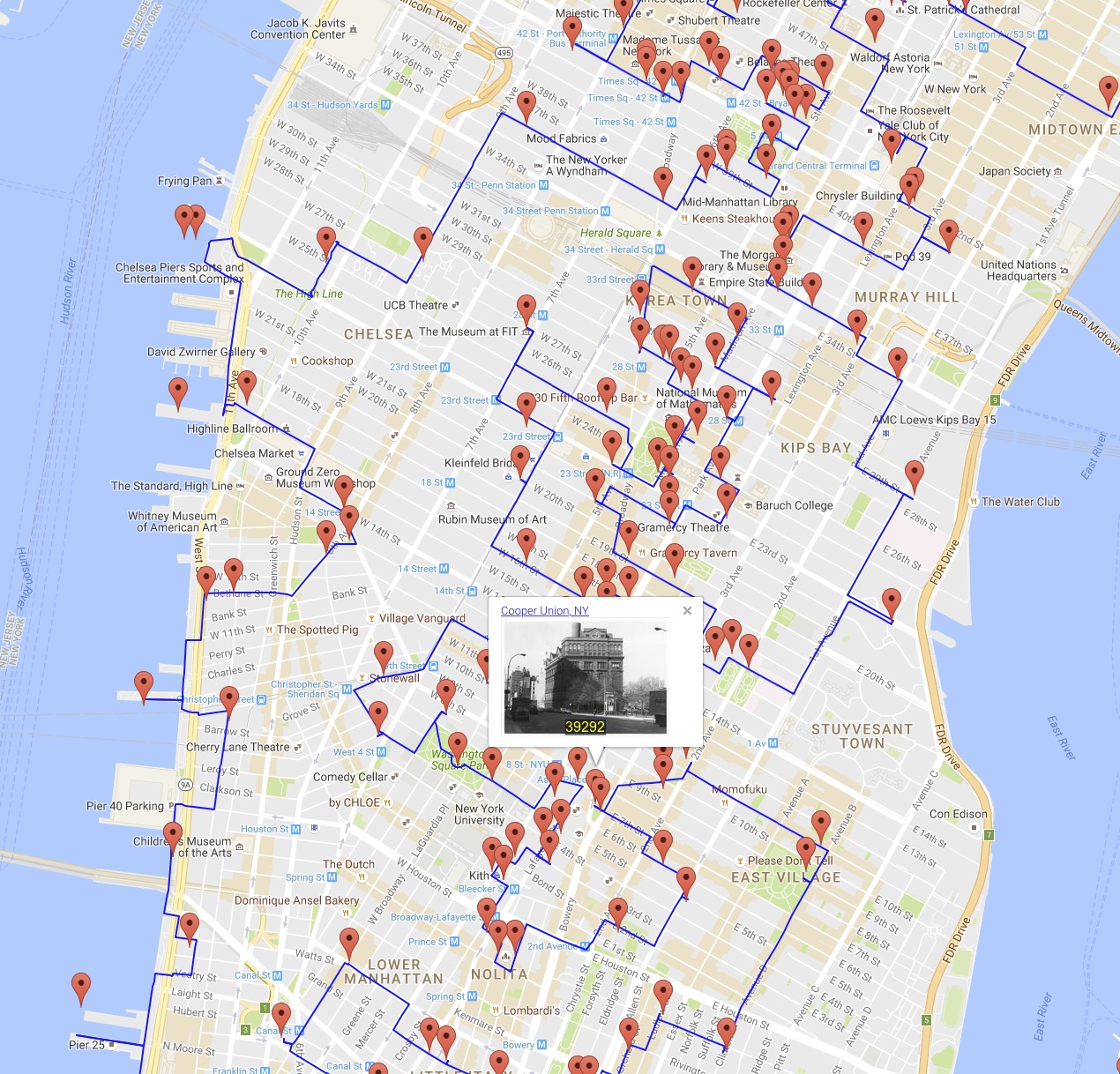
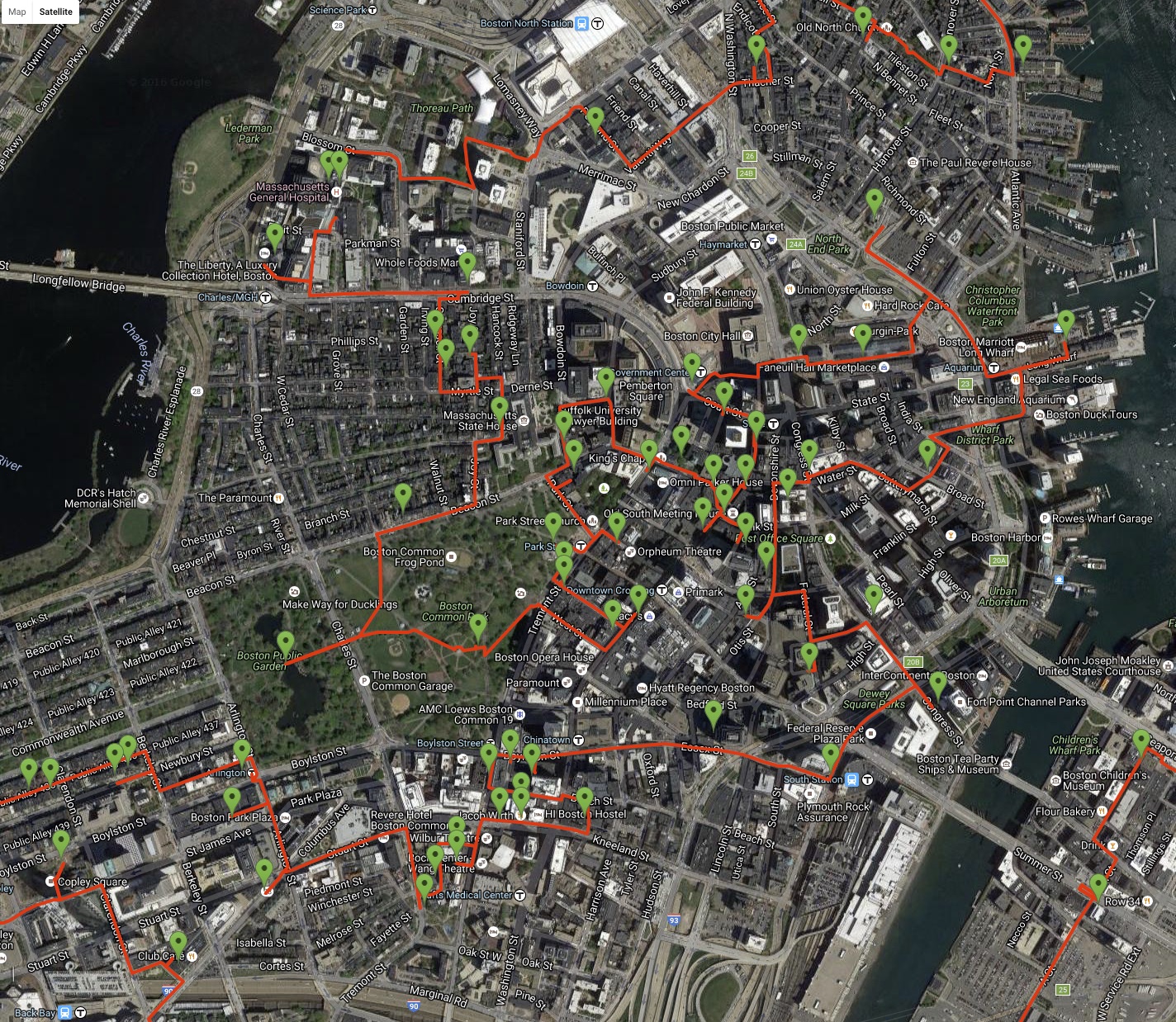
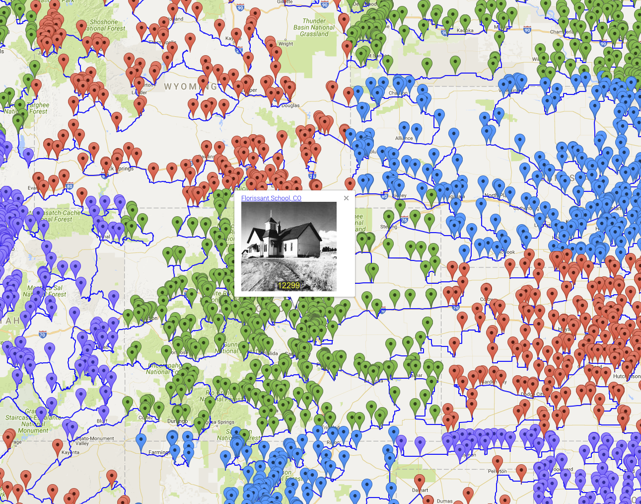
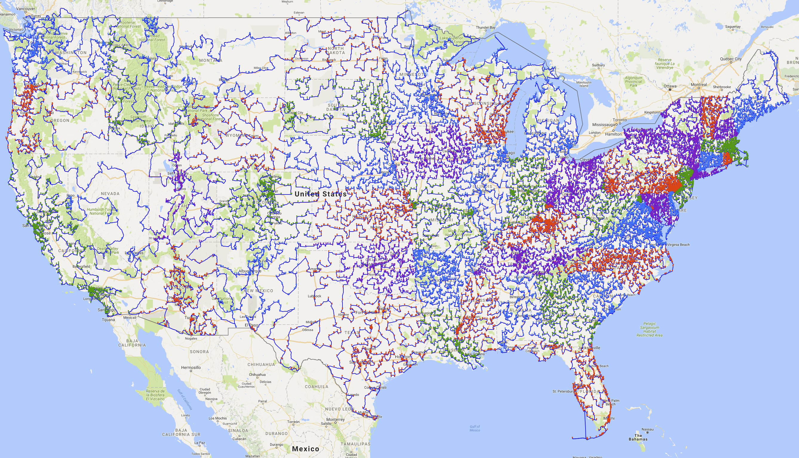
Please note that there is a lot of information packed into the map and it can be slow at responding to some commands. Allow me to offer a few tips on how to navigate around the tour. A screenshot of the map is given above. The markers indicate the locations of the historic sites and the blue lines show the route. If you zoom out too far, the map needs to draw thousands of markers and lines. This is fine, if you have a bit of patience, but panning the zoomed-out view can be painfully slow. To move around, I suggest using the city buttons on the right-hand-side. Clicking one of the buttons will change the view to that city center. To see a line drawing without the markers, click the Marker On/Off button. It will take a few seconds for the map to update.
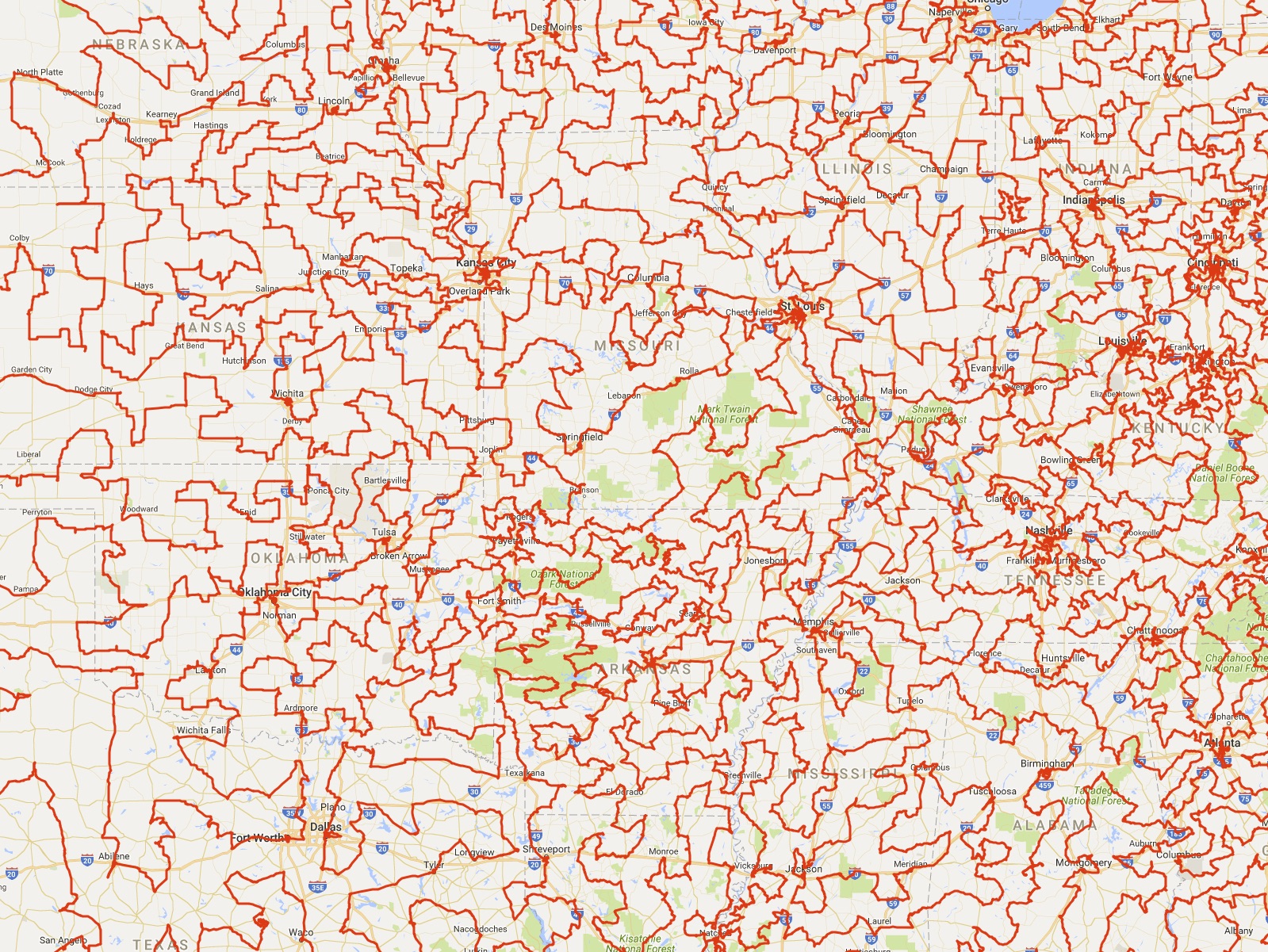
If you have a sturdy computer and a fast Internet connection, click here for a version of the map showing the full nationwide view of the tour.
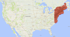
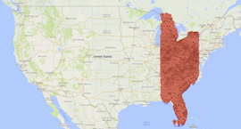
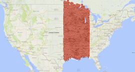
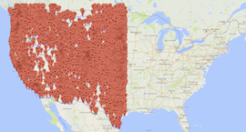
On the other hand, if you are viewing the page with a phone or tablet, or you are having loading problems, please try one of the regional maps below, where we have split the tour over four files. Or, better, yet, go to the State Maps page for a close-up view of the tour as it passes from state to state.
Alternatively, here is a link to a high resolution drawing of tour.
And if you are in the mood for a day's walk around the nation's capitol, have a look at the Washington page.
Menu links for Boston, New York, Philadelphia, Portland ME, Richmond, and Washington DC.
Menu links for Atlanta, Cincinnati, Detroit, Pittsburgh, Richmond, and Washington DC.
Menu links for Houston, Kansas City, Minneapolis, Nashville, New Orleans, and St. Louis.
Including menu links for Denver, Los Angeles, Omaha, Phoenix, Portland, Salt Lake City, San Francisco, and Seattle.